
Apacheta at the GEO Global Forum 2025 in Rome
High-Resolution Tools for High-Stakes Regions
At the Group on Earth Observations (GEO) Global Forum 2025, held in Rome, Italy, Apacheta contributed to dialogue on the future of land monitoring, resilience-building, and data accessibility for the world’s most vulnerable regions. The forum brought together scientists, policymakers, and geospatial experts from over 100 countries to accelerate progress on Earth intelligence for sustainable development.
Apacheta’s contributions focused on one of the most urgent and complex global challenges: land degradation in Small Island Developing States (SIDS). These territories, especially vulnerable to climate change and resource pressures, require customised monitoring tools, community engagement, and scalable data solutions.
ODOK Booth: Apacheta Unveils New LPD Tools and Datasets for SIDS
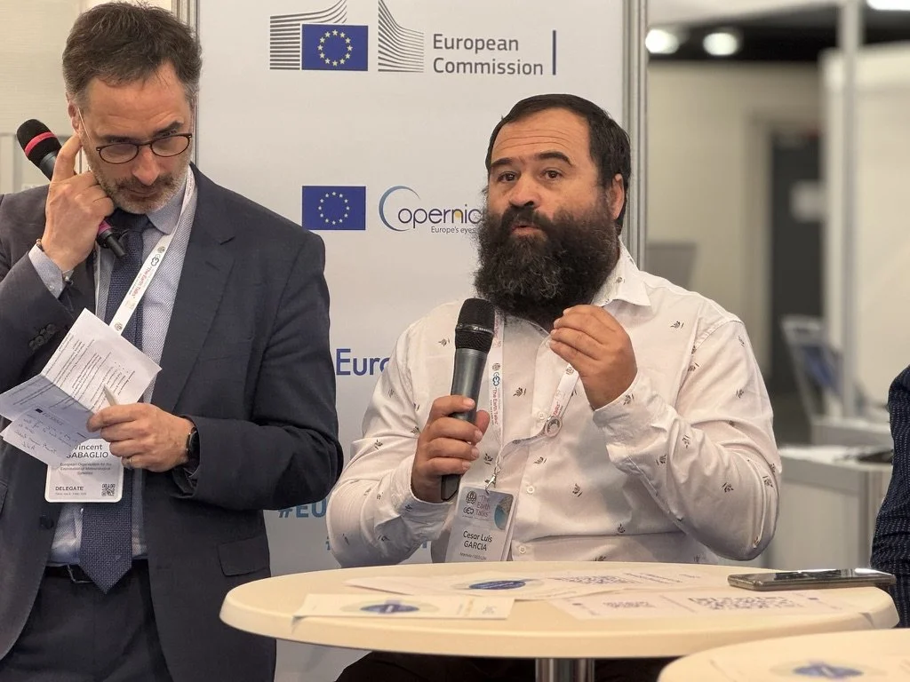
Apacheta launched its participation at the GEO Knowledge Hub’s ODOK booth, where CEO Cesar Luis Garcia—also co-lead of GEO-LDN Working Group 4—presented pre-release versions of two high-resolution Land Productivity Dynamics datasets designed specifically for 40 SIDS:
LPD-FW2 (FAO-WOCAT version 2)
Created using a new algorithm Landsat Mixed Dataset, this product delivers a 30-meter resolution time series from 2000-2023 and the calculation of the Land Productivity Dynamic indicator for SIDS. It was developed in partnership with Conservation International (CI) and Partnership Initiative for Sustainable Land Management (PISLM).
This tool is tailored to improve the capacity of SIDS to track land degradation, inform UNCCD reporting, and design land restoration strategies with spatial precision.
HiLPD (High-Resolution LPD)
Based on a recently published methodology developed in collaboration with the Chinese International Research Center of Big Data for Sustainable Development Goals (CBAS), HiLPD employs a Landsat–MODIS fusion approach to provide enhanced consistency and granularity. The underlying research is publicly available here.

Both products will now undergo joint testing and refinement with selected SIDS stakeholders in preparation for official release ahead of the 2026 UNCCD reporting cycle.
EuroGEO Roundtable: Managing Droughts, Floods, and Land Degradation in Vulnerable Regions
At the EuroGEO booth, Apacheta joined a high-level panel discussion titled “Managing Droughts, Floods, and Land Degradation in Vulnerable Regions.” The roundtable brought together prominent Earth observation institutions and technical agencies, including: EUMETSAT (European Organisation for the Exploitation of Meteorological Satellites), CNR-IIA (Italian National Research Council – Institute of Atmospheric Pollution Research), Italian Civil Protection Department, CLS France and Conservation International (representing GEO-LDN Working Group 3).
Cesar Garcia’s presentation focused on Apacheta’s efforts to deliver actionable EO-based tools for SIDS, highlighting the critical intersection of data resolution, user access, and co-design. The session reinforced a core theme: that advanced geospatial systems must be driven by community realities and built with input from the users they intend to serve.
Our Goal: Collaborative Innovation
Apacheta’s engagements in Rome demonstrated a strategic model for innovation: science-based yet user-centered, technically rigorous yet locally relevant. The organization's open-access tools, collaborative development processes, and multi-institutional partnerships reflect its belief that data must be not just available, but usable—especially by those on the frontlines of land degradation.