Land Cover Trends in Small Island Developing States (SIDS)
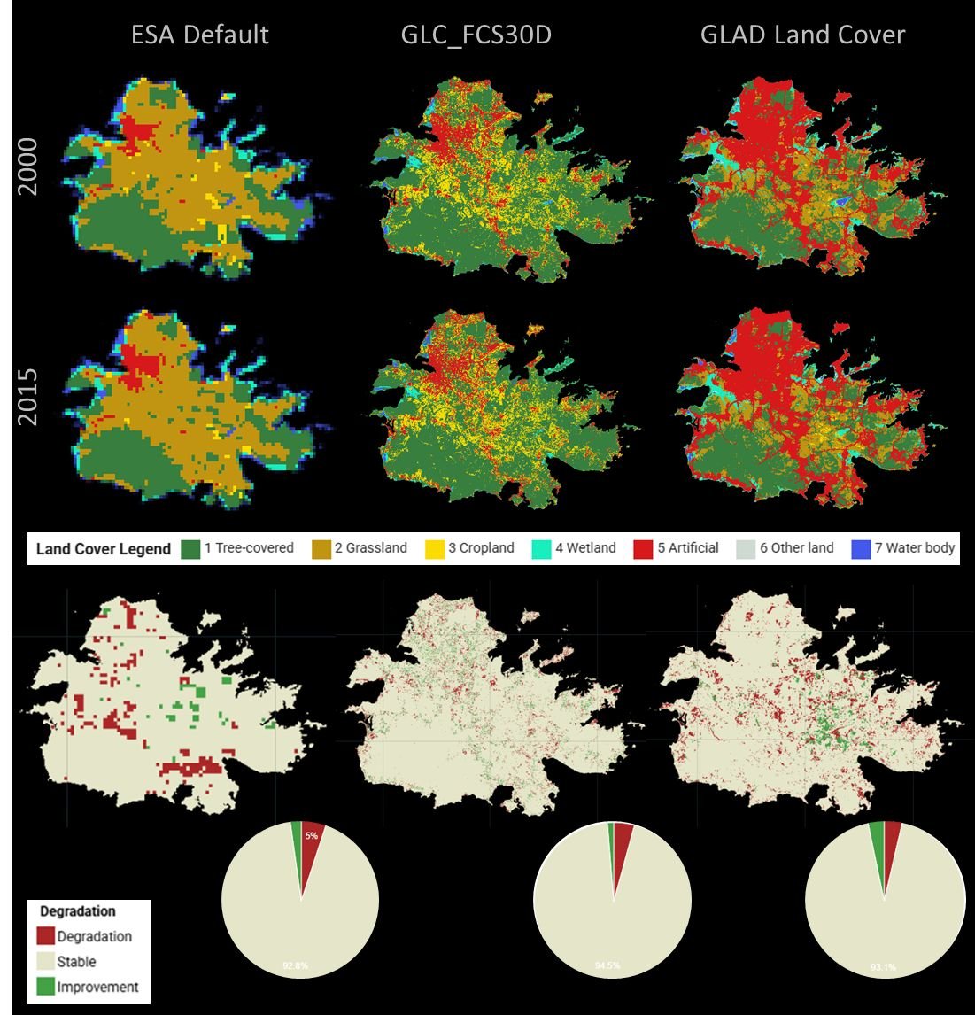
How consistent are global land cover datasets when applied to SIDS? Our latest work explores this question by comparing three datasets across 40 Small Island Developing States: ESA CCI-LC (300m), GLC-FCS30D (30m), and GLAD Land Cover (30m).
This research supports monitoring of SDG Indicator 15.3.1 and informs the UNCCD 2026 reporting process. It reveals key differences and overlaps—especially in classifications of urban, cropland, grassland, and wetland areas—underscoring how methodological approaches and definitional nuances shape interpretations of land cover dynamics.
To help navigate these challenges, Apacheta and PISLM CSIDS developed the Land Cover Transition Tool in Google Earth Engine. This interactive platform enables users to:
Explore land cover changes across three reporting periods (2000–2015, 2015–2019, 2015–2023)
Access area statistics and transition matrices
View side-by-side visual comparisons
Designed for national reporting teams, policymakers, and land monitoring experts, the tool supports more transparent and evidence-based decision-making.
Explore the study and tool here: https://lnkd.in/dWk7-VQg
Authors: Cesar Luis Garcia, Eugenia Raviolo, Ezequiel Francisco Pozzi Tay, Franklin Paredes-Trejo, Ronen Francis, Calvin James


